
Featured Photographer
John Shelton
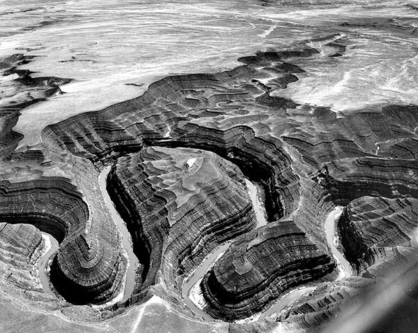
San Juan River Goosenecks
John Shelton believed in showing rather than telling. A geologist and educator by vocation, he used his passion for flying and his skills in photography to produce a book filled with breathtaking images of the Earth. His photographs include glaciers and a multitude of landforms throughout the world. Dr. Shelton's photographs of landforms helped generations of geology students. His book, Geology Illustrated, was chosen as one of the top 100 science books of the 20th century by American Scientist magazine.
John Sewall Shelton was born Sept. 2, 1913, in Hanover, N.H. He was the oldest of three boys born to Henry Wood Shelton and Dorothy Camp Shelton. In 1923, the family moved to La Jolla, California. He was home-schooled until he entered the seventh grade at Francis Parker School. He graduated from La Jolla High School and went on to Pomona College in Claremont where he majored in math and music.
He started his career teaching geography at Francis Parker School in San Diego. His excitement for the educational possibilities of field trips spurred him to pursue a graduate degree in geology from Yale University.
He joined the geology department at Pomona College in 1941. He learned to fly in the early 1940s and started taking aerial photographs of the Earth's surface while piloting his own plane. He began taking photos as a way to demonstrate geology to his students and also as a way to combine his three passions: flying, photography and geology. From the 1930s through the 1990s, Dr. Shelton photographed evidence of continental drift, plate tectonics and other geological principals all over the globe. His large collection of photographs taken throughout the world are still used to teach geology nationwide.
In the 1960s, he was a consultant for Encyclopedia Britannica Films and traveled around the world helping make educational films.
Dr. Shelton's work earned him awards from the American Geological Institute and the National Association of Geoscience Teachers. In 1993, Shelton received the American Geological Institute Legendary Geologist Award for “Outstanding Contribution to Public Understanding of Geology.” Dr. Shelton died in 2008.
Some material from San Diego Union-Tribune, 2008.

San Andreas Fault, offsetting gully West of Taft

Drumlins east of Rochester

Landslide at Puente Hills

Virgin anticline
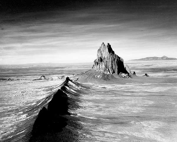
Shiprock
Monument Valley

Great Unconformity in Grand Canyon, near Shinume Creek & Powell Plateau
untitled
Alluvial fans, East wall of Death Valley, California
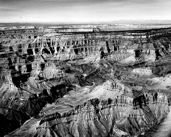
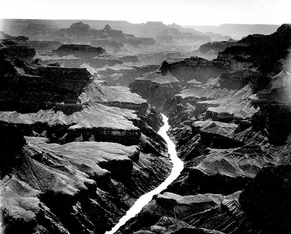
South side of Colorado River, upper Grand Canyon
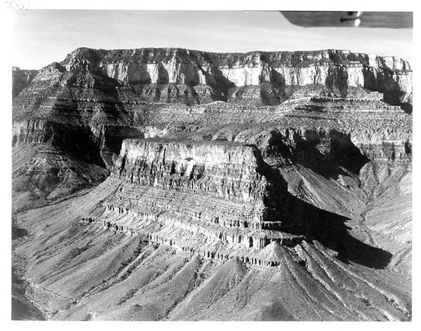
Looking upstream in Grand Canyon between Village and Shinumo Creek
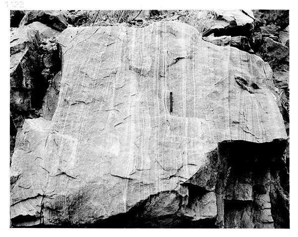
Crossbedding in block of quartzite (probably Shinumo) on lower Kaibab trail

View downstream about 1/2 mile below Bright Angel Creek, showing faulted Hakatai shale (against Vishnu schist)

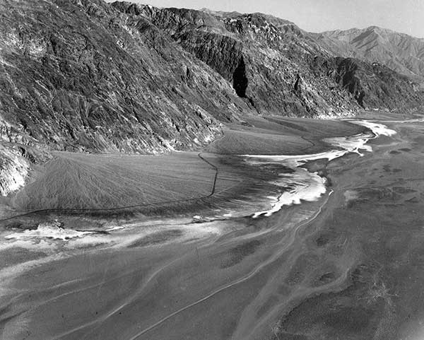
Virgin River Delta entering Lake Mead at lower left
San Juan River goosenecks, below Mexican Hat, Utah, July 9, 1958

White Cone Peak, Hopi Buttes

Meteor Crater

Lake Mead shoreline, natural contour and submerged shoreline

Escarpment

Barchan dunes

Strike ridges at Tyrone Gap, East of Mount Hope mine, North of Eureka, Nevada, October 16, 1958

Open pit copper mine, Bingham Canyon, Utah, October 17, 1958
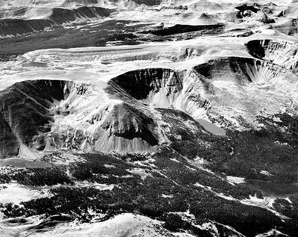
Cirques and Uinta crest, Uinta Valley, Utah, October 17, 1958
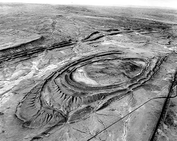
Sinclair Dome, 6 miles East of Rawlins, Wyoming, October 30, 1958

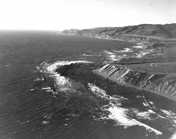
General view of Miocene unconformity on Cretaceous, Turtle Bay, Baja California, Mexico, February 2, 1960

Close-up of gastropods from Redwall Limestone collection (McKee & Gutschick) at Denver Federal Center, Colorado, April 17, 1959
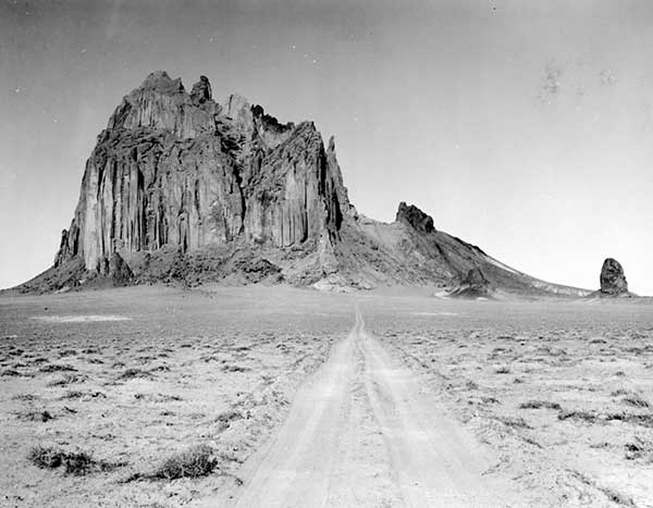
Ship Rock, New Mexico, April 22, 1959
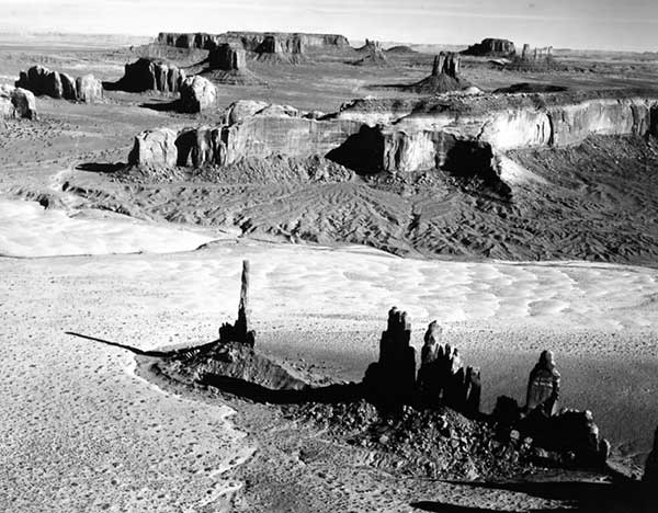
Monument Valley, Utah, April 28, 1959

Red Slate Mountain roof pendent.

Cinder Cone from Emigrant Trail
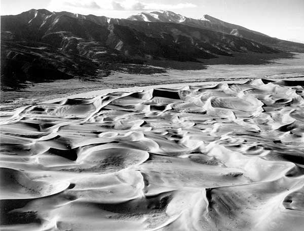
Southern edge of Great Sand Dunes National Monument